
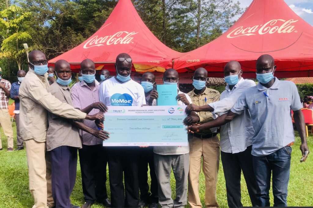


The forest is situated between Nyangtonzi and Kisabagwa Parishes in Budongo and Kyabigambire Sub-counties in Masindi and Hoima districts respectively. It is about 50km West of Masindi town and 22km East of Hoima. The forest adjacent villages are Katanga, Katugo I, Katugo II, Rwentale I, Rwentale II, Bineneza in Nyantonzi Parish Budongo Sub-county-Masindi district and Bineneza in Kisabagwa parish-Kyabigambire Sub-Sub-county Hoima district. It lies to the western part of Masindi town at a distance of about 50km along Masindi-Butiaba road off at mile 22 following Karongo-Nyantonzi-Katasiha road . Spatially, on the world map, it lies between Latitude (1o53”30’N) and Longitude (31o46”0’E). The legal registered institution is BINENEZA COMMUNAL LAND ASSOCIATION. It is mapped with the aid of a Global Positioning Systems and data processed by use of Geographical Information Systems (GIS) to compute an area of 200Ha.
Bineneza Community Forest
Alimugonza community forest is situated in Pakanyi sub-county, Buruli county, Masindi district. It lies to the north east of Masindi town at a distance of about 31km. It boarders with Murchsion Falls National Park in the northern part, Kinura village in the south, Kimina village in the east and Kaborogota village in the west. Alimugonza community forest which comprises a mixed forest and a woodland forest type covers an area of about 24 hectares. Spatially, on the world map, it lies between Latitude (1o53”30’N) and Longititude (31o46”0’E). The legal registered institutional name is Alimugonza Community Forest; it is mapped with the aid of a Global Positioning Systems and data processed by use of Geographical Information Systems (GIS) to compute and area of 24Ha.
Alimugonza Community Forest
Motokai community Forest is situated in Nyatonzi Parish and Nyabyeya parish, Budongo Sub-County, Bujenje County, Masindi District. It lies to the western part of Masindi town at a distance of about 32 km along Masindi – Butiaba road. It borders with Karongo village in the northern part, Nyabigoma village in the east, and Ekarakaveni I in the west. It lies to the north east of Masindi town at a distance of about 31km. Motokai community forest which comprises a mixed forest and a woodland forest type covers an area of about 18 hectares. Spatially, on the world map, it lies between Latitude (1o53”30’N) and Longititude (31o46”0’E). The legal registered institutional name is MOTOKAI COMMUNITY FOREST; it is mapped with the aid of a Global Positioning Systems and data processed by use of Geographical Information Systems (GIS) to compute and area of 21Ha.
Motokai Community Forest
Tengele forest covers an area of 52ha and is massively degraded and needs rehabilitation. It is situated in Nyantonzi Parish, Budongo Sub-county and about 40km West of Masindi town. It is surrounded by four villages of Rwentale I and II, Kabali and Nyantonzi Trading centre. Tengele community forest which comprises a mixed forest and a woodland forest type, spatially, on the world map, lies between Latitude (1o 38”0’ and 1o 38”30’N) and Longititude (31o28”30’ and 31o29”0’E). The legal registered institutional name is Tengele Community Forest; it is mapped with the aid of a Global Positioning Systems and data processed by use of Geographical Information Systems (GIS) to compute and area of 50.3Ha.
Tengele Community Forest
Kaitampiisi Community Forest is situated between Nyabyeya and Kabango Parishes, Budongo Sub-County, Bujenje County, Masindi District. It lies to the western part of Masindi town at a distance of about 28 km along Budongo Saw Mill road off Butiaba at Bwinamira I village. The other access roads are Mubende-Kyankade-Ewafala-Nyabyeya II road and Kyankade-Kadukulu II and I road. Spatially, on the world map, it lies between Latitude (1o53”30’N) and Longitude (31o46”0’E). The legal registered institution is KAITAMPIISI COMMUNAL LAND ASSOCIATION. It is mapped with the aid of a Global Positioning Systems and data processed by use of Geographical Information Systems (GIS) to compute an area of 57Ha.
Kaitampisi Community Forest
Kyamasuka community Forest is situated between Nyabyeya and Kabango Parishes, Budongo Sub-County, Bujenje County, Masindi District. It lies to the western part of Masindi town at a distance of about 28 km between Masindi – Butiaba road and Budongo saw mill road. Also joining Budongo Saw Mill road to Butiaba road is the Kadukulu I-Lugazi-Kyempunu road that runs East-West that enables one to access it almost throughout the length of the forest. Spatially, on the world map, it lies between Latitude (1o53”30’N) and Longitude (31o46”0’E). The legal registered institution is KYAMASUKA COMMUNAL LAND ASSOCIATION. It is mapped with the aid of a Global Positioning Systems and data processed by use of Geographical Information Systems (GIS) to compute an area of 65Ha.
Kyamasuka Community Forest
The forest is situated in Kimanya upper village in Nyantonzi Parish in Budongo Sub-county- Masindi district. It is about 28km West of Masindi town through Kinyara Sugar limited factory. Spatially, on the world map, it lies between Latitude (1o53”30’N) and Longitude (31o46”0’E). The legal registered institution is RWENTUMBA COMMUNAL LAND ASSOCIATION. It is mapped with the aid of a Global Positioning Systems and data processed by use of Geographical Information Systems (GIS) to compute an area of 200Ha.
Rwentumba Community Forest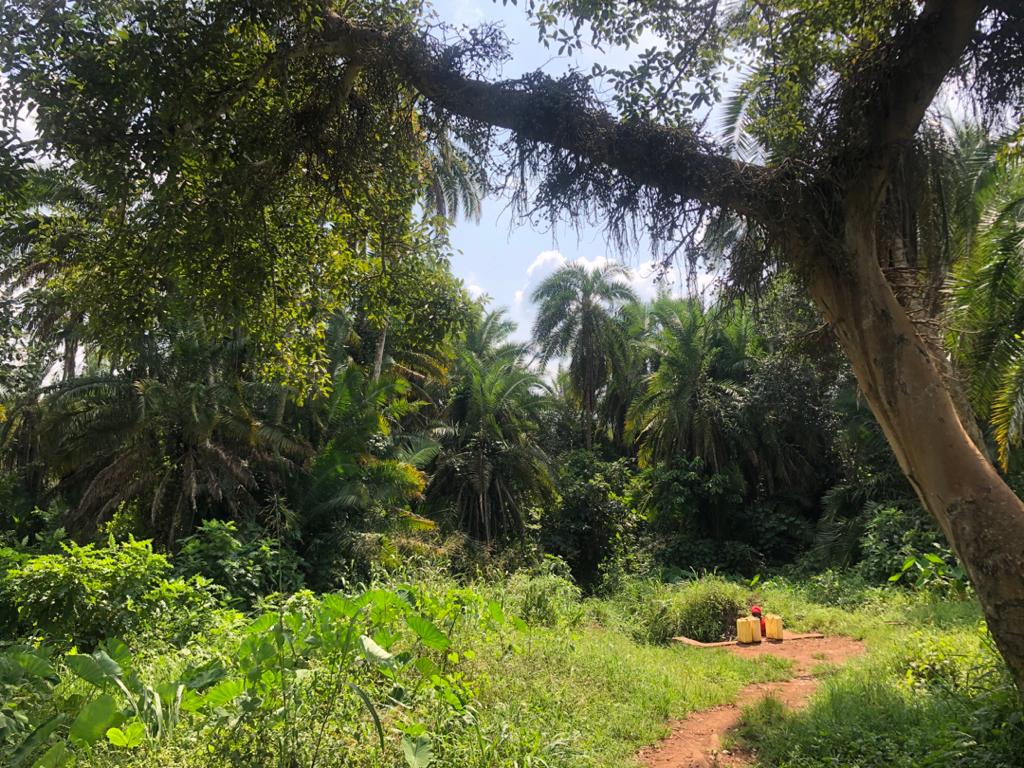
Siiba Community Forest is situated in Kabango, Kasongoire, Nyantonzi and Nyabyeya Parishes, Budongo Sub-county, Bujenje County, Masindi district. It stretches along Masindi-Biiso road approximately 28-35km West of Masindi town. The forest adjacent villages are Kidamukye, Bwinamira I, Bwinamira III, Bulyango, Kyamongi, Ekarakaveni II, Ekarakaveni I, Siiba, Nyabigoma nd Karongo. It is a water catchment for the above adjacent villages that provides spring wells in the respective villages. It lies to the western part of Masindi town at a distance of about 18-15 km at the edge of Masindi-Biiso road off Bwinamira I-Kasongoire road and Karongo-Nyantonzi road. Spatially, on the world map, it lies between Latitude (1o53”30’N) and Longitude (31o46”0’E).
Siiba Community Forest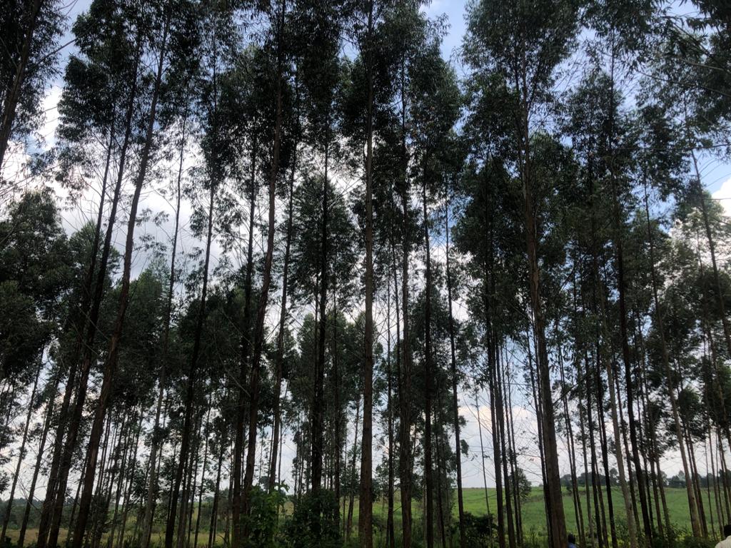
Sonso Community Forest is situated Kabango Parish (Kabango Town Council), Budongo Sub-County, Bujenje County, Masindi District. It lies to the western part of Masindi town at a distance of about 12 km at the edge of Masindi-Biiso road off Mubende-Kapeka road. The forest can also be access through Mubende-Kyankade-Ewafala road. Spatially, on the world map, it lies between Latitude (1o53”30’N) and Longitude (31o46”0’E).
Sonso Community Forest
Follow Us On